Tweddle/Treat Farm at Sleeping Bear Dunes via NPS
Now for a “Treat” you’ll have to take a hike – but it is well worth the effort! The trail that leads from the corner of Norconk Road into the woods is about ½ mile long through the maple-beech forest and will take you to the Treat Farm. As you reach the top of the hill, the canopy of trees opens up to a view of the farmstead. A portion of the original barn has been rebuilt on the original foundation. Visitors are drawn to this intriguing farmstead for several reasons. The trail leading up the slight incline from Norconk Road holds an allure of its own… it seems to beckon passers-by. It piques the curiosity by conjuring visions of what might be at its terminus. It is also one of the most beautiful areas for spring wildflowers in all of Michigan! – >> Read More >>
More Sleeping Bear Dunes Skiing, Snowshoeing and Winter Fun
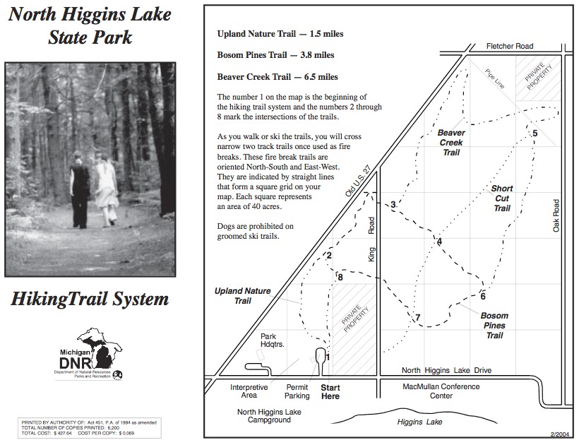
North Higgins Lake State Park has 11 miles of cross-country ski trails. The trails wind through the mixed hardwoods that make up the mature wooded area. They cross over moderate hills and flatlands.
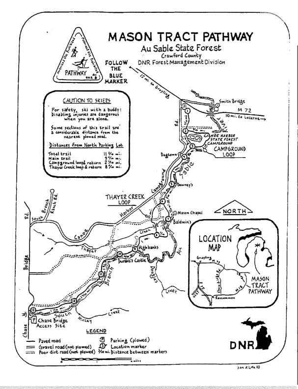
The Mason Tract Pathway Ski Trail is a 11.5 mile ungroomed skiing (and hiking) trail that follows the famous South Branch of the AuSable River.
It is a point-to-point trail, located southeast of Grayling.
The Mason Trace Pathway can be accessed at the Canoe Harbor State Forest Campground, just off of M-72 east of Grayling.
The southern access of the trail is located just off Chase Bridge Road.
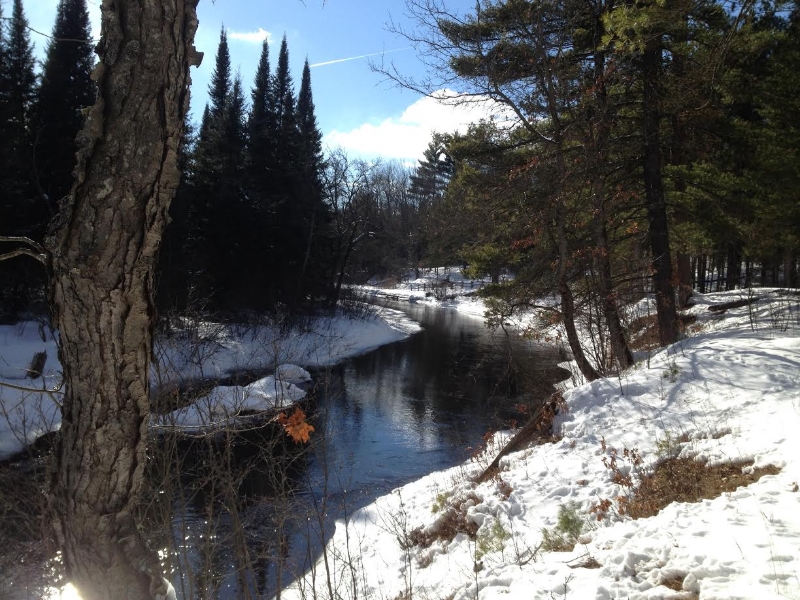
This scenic ski trail takes you along the west bank of the Ausable River and winds through forest and meadows. It is a very scenic and some sections are quite remote. Keep an eye out for wildlife and enjoy the great views of the AuSable River at the High Banks section of the trail.