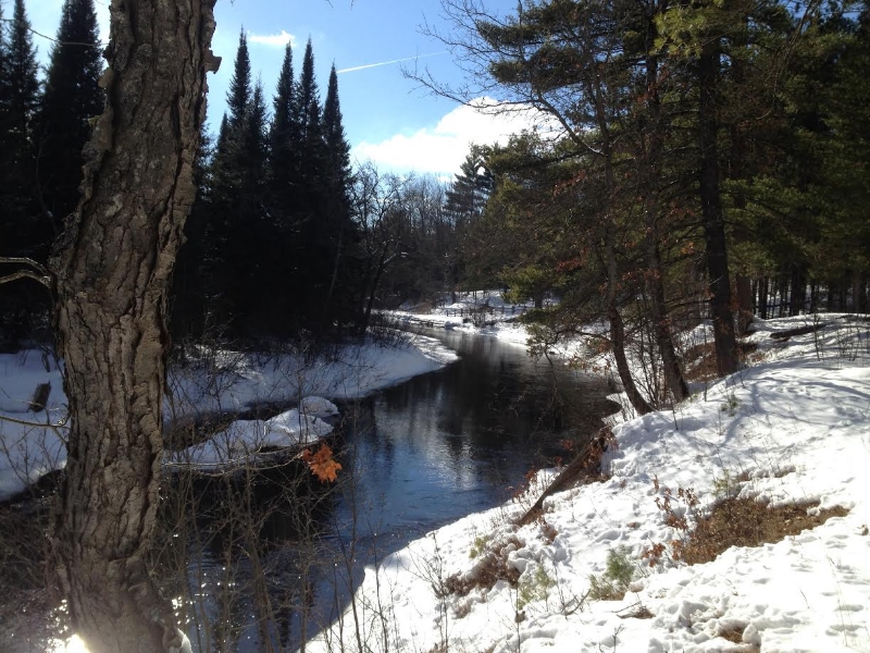
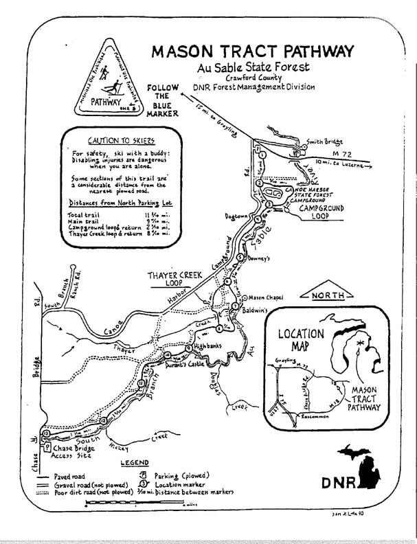
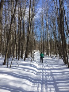
The Mason Tract Pathway Ski Trail is a 11.5 mile ungroomed skiing (and hiking) trail that follows the famous South Branch of the AuSable River.
It is a point-to-point trail, located southeast of Grayling.
The Mason Trace Pathway can be accessed at the Canoe Harbor State Forest Campground, just off of M-72 east of Grayling.
The southern access of the trail is located just off Chase Bridge Road.
This scenic ski trail takes you along the west bank of the Ausable River and winds through forest and meadows. It is a very scenic and some sections are quite remote. Keep an eye out for wildlife and enjoy the great views of the AuSable River at the High Banks section of the trail.
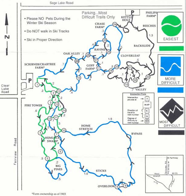
The Ogemaw Hills Pathway cross-country ski trails wind through approximately 15 miles of the AuSable State Forest providing groomed cross country trails for all skill levels.
The Ogemaw Hills Pathway is located at the corner of Clear Lake Road and Fairview Road. Take Exit 212 (West Branch Exit) following Business Loop 75 to Fairview Road (5 miles to Ogemaw Hills Pathway).
There is no cost to use the Pathway. Private donations help fund upkeep and maintenance. If you would like to make a donation, please send to: Ogemaw Hills Ski Council
422 W. Houghton Ave.
West Branch, MI 488661
Below are the latest postings from the Ogemaw Hills Pathway Ski Trails Page On Facebook.
<>
This message is only visible to site admins Problem displaying Facebook posts.
PPCA Error: Due to Facebook API changes it is no longer possible to display a feed from a Facebook Page you are not an admin of. The Facebook feed below is not using a valid Access Token for this Facebook page and so has stopped updating.
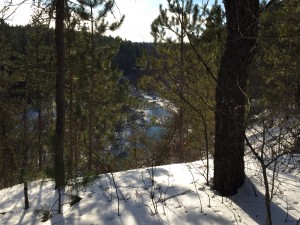
Bob & Lynne Frye went looking for the Elk herd on the Shingle Mill Pathway this past Wednesday. The Elk were not to be found but a true wilderness adventure was!
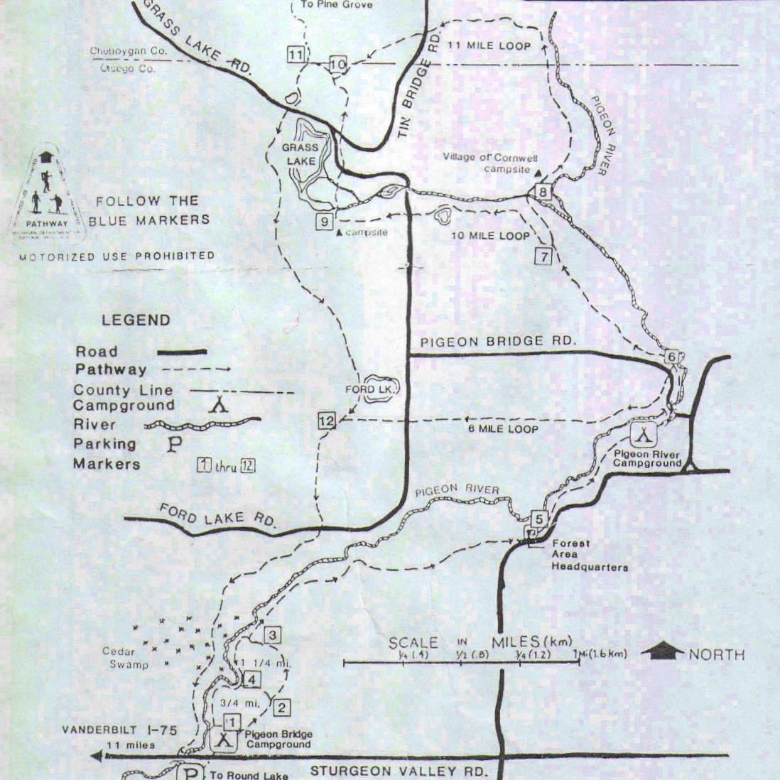
The Pigeon River Country’s most popular hiking and cross-country skiing trail, the Shingle Mill Pathway begins at the Pigeon Bridge Campground located just off Sturgeon Valley Rd. eleven miles east of the village of Vanderbilt.
Heading NE along the east bank of the Pigeon River, the trail actually branches off into five separate segments of different lengths, ranging from short 3/4 and 1&1/4 strolls to 6, 10, and 12 mile excursions, the latter three crossing to the west bank of the river at the Pigeon River Campground, and eventually bringing the hiker or skier back to the Pigeon River Bridge on Sturgeon Valley Road.
Cross-country skiers should be aware that the terrain becomes increasingly challenging as the length of the selected loop increases, with the 10 and 12 mile loops involving some steeper hills.
Although bicycles are presently allowed on the pathway, cyclists are urged to be extra cautious to avoid eroding the steeper parts of the trail and be prepared to walk at times. Right of way must always be given to those on foot.
Horses and snowmobiles are forbidden to use the Shingle Mill Pathway at all times.